Unique Canadian Map Art
Gary Worrall at Pocket Wolf Studio creates hand-crafted maps that will inform, inspire and motivate you to explore the world around you! Each one of our high-quality map products include thousands of design elements – geographic and historical information compiled over hundreds of hours of research.
BE INFORMED ~ STAY INSPIRED ~ GO EXPLORE
VISIT US AT AN UPCOMING CRAFT MARKET OR
CALL 807.727.0900 TO ORDER YOUR POCKET WOLF STUDIO MAP
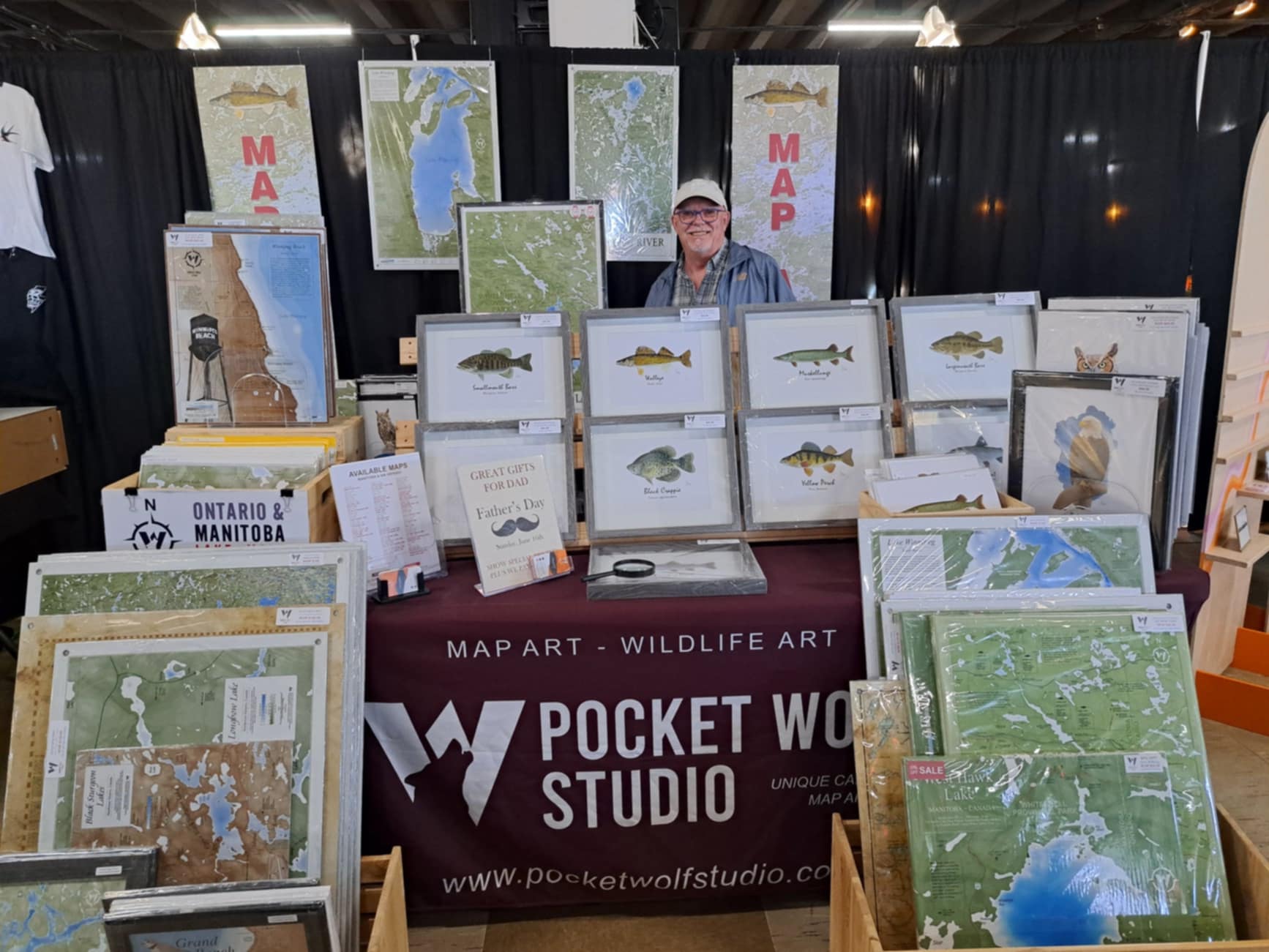
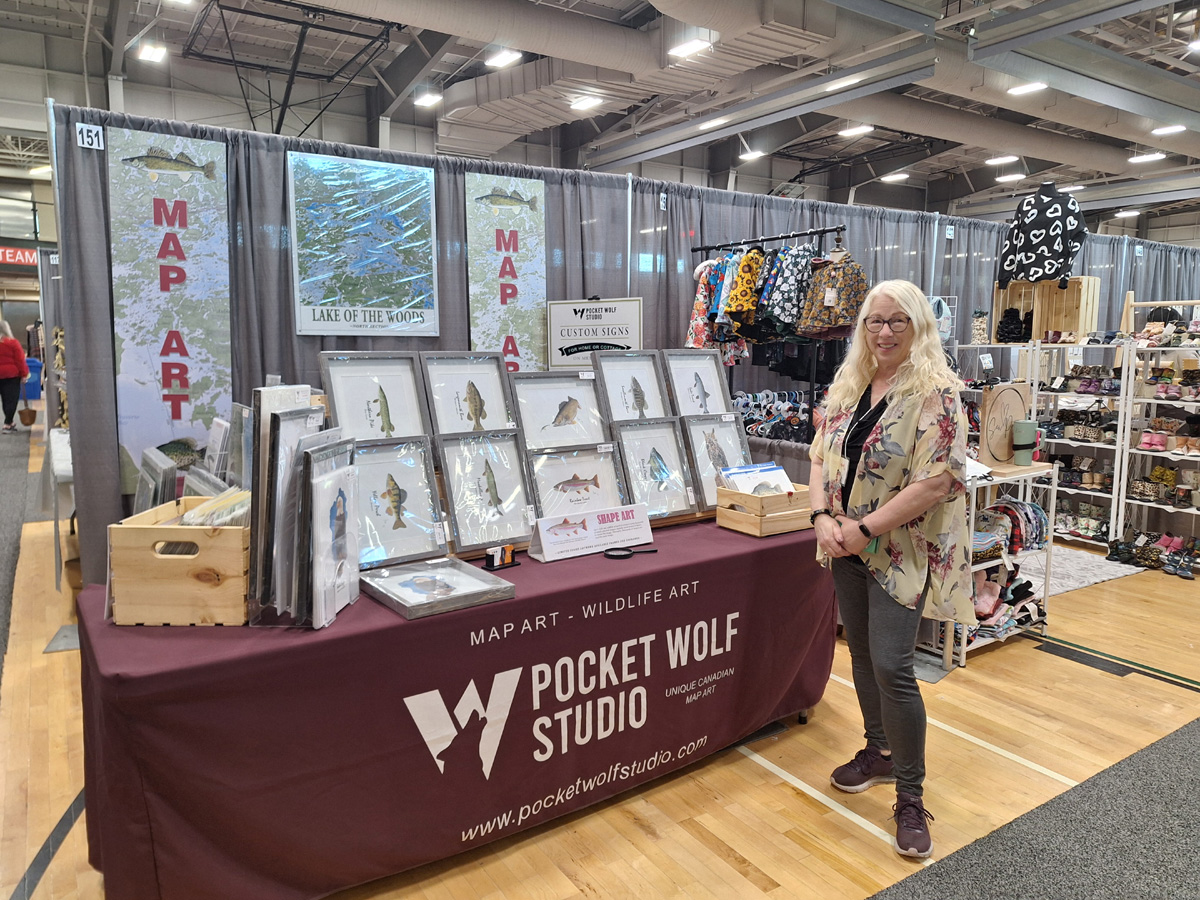
Visit Gary and Penny at a local market
St Norbert Farmer’s Market (when booth space is available)
Saturdays 8am to 2pm (summer) 10am to 2pm (winter)
Inspirations Market Artisans Alley – Red River Exhibition Place
10am to 4pm
Saturday, November 1, Sunday, November 2
Dakota Community Centre Christmas Market
10am to 4pm
Saturday November 8, Sunday November 9

HIGH QUALITY METAL PANELS
Our maps are printed directly onto 1/8” metal panels produced from two sheets of pure aluminum enclosing a lightweight black plastic core. State of the art printing using UV resistant inks result in high definition, deep vivid colours and superior longevity. Aluminum panels are lightweight, sturdy and waterproof, adding an elegant finish to any space including open-air areas with a long-lasting UV coating.
CHOICE OF MOUNTING OPTIONS
EASY TO HANG: All of our metal map products can be attached to your wall with flush mount clips, or standoff hardware which are included at no additional cost. Additionally, you can choose our Nielson Art Metal Frame at an additional cost. If you wish to arrange for your own frame please choose the flush mount.
FLUSH MOUNT – Included
For a more traditional look, select the Flush Mount option which are used to attach your map directly to your wall. Easy to install with the included screws and anchors. You should also choose this option if you wish to frame it yourself.
STAND OFF MOUNT – included
For a more dramatic look, choose the standoff mounting method that elevates your map from the wall creating shadow and depth. The map comes with predrilled holes. Easy to install with the included screws and anchors.
NIELSON ART FRAME – additional cost
Our “Classic” Nielson metal frames are only available in polished black. These simple 3/4″ frames add an additional touch of elegance to your map. This option is an additional price and can be selected when purchasing your Pocket Wolf Studio map product.


CUSTOMIZING YOUR MAP
While our map series covers a large number of lakes in Northwest Ontario and Southern Manitoba, we are also able to provide custom services creating a map of your favorite lake, designed and printed to meet your preferences. We can also customize one of our existing maps to include the location of a cottage or home, local geographic names, a custom title or even a photo of that big fish.
- Custom Size
- Custom Colour
- Custom Text
- Personalized Title
- Cottage/Home Marker
- Photos and Illustrations
PATHFINDER MAP SERIES
VISIT US AT AN UPCOMING CRAFT MARKET OR
CALL or TEXT 807.727.0900 | Email: info@garyworrall.com
TO ORDER YOUR POCKET WOLF STUDIO MAP
- Prices include mounting hardware (command strips, stand-off hardware, or flush mount hardware)
- Prices are for High Quality Metal Prints (unless described otherwise).
- Prices do not include frames (unless described otherwise).
- We accept all major credit cards, debit cards, Interact eTransfer
- All maps over 24″x24″ are available in green or brown tones
- Prices do not include shipping – Orders orer $175 are free delivery within Winnipeg.
- We use Canada Post Parcel Service for all orders outside of Winnipeg
- PLEASE NOTE: Due to US Tariff controls we no longer ship to the USA